Welcome!
The Planning Division provides guidance, reviews zoning, and subdivision applications for the city. This division shapes public policy related to growth, preservation and development. It also advises and provides recommendations to the City Manager, City Commission, residents, the business community, and the public on current land use and development issues. The Planning Division oversees all applications for discretionary permits needed to meet those requirements.
The Planning Division also maintains the General Plan and Zoning Ordinance and maps that provide the policy and regulatory bases for land use and development as mandated by state and local laws. We are committed to proactive community based planning founded on public participation and to promoting a well designed, physically-integrated, livable, sustainable and prosperous City.
Applications
Starting a new construction project? Unless you are building a single family residence, you will need to get a Plan Approval from the Development Services Department. Learn when you need to go through planning and zoning for development applications, what documentation you’ll need, apply online, view review status, pay fees and all from your home, office or mobile device.
All development plan and permit related applications are required to be submitted using the Citizenserve Portal. The portal allows for online submission of all applications listed below as well as payment of required fees. Please follow the procedures for Naming of Electronic Documents that are uploaded in Citizenserve so your submittal is processed in a timely manner.
For more information please call the Planning Division at 407.688.5140.
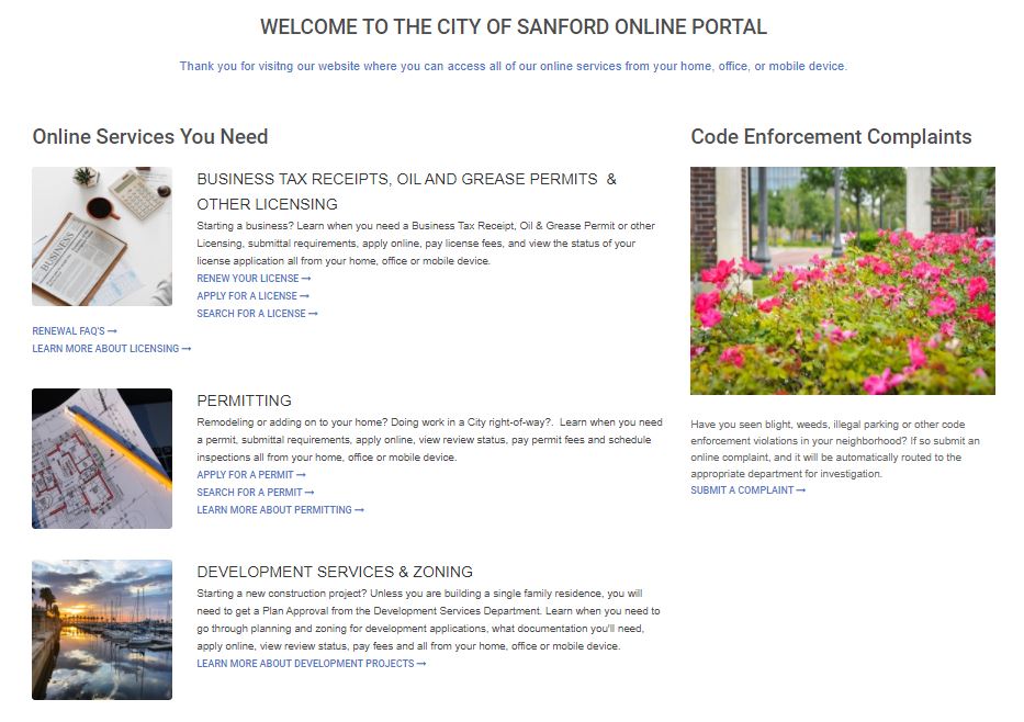
Citizenserve Portal
Visit our website where you
can access all of our online
services from your home, office,
or mobile device.
Planning Maps
Interactive Maps
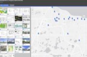
Development In Progress
View under construction and proposed developments
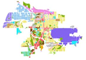
Sanford FLU
This map shows Future Land Use designations for the city
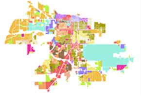
Sanford Zoning
Uses for parcels and the design and development guidelines
Planning and Development FAQs
Zoning is the principal tool used in regulating the use of land in many communities. Zoning classifies land uses into specific categories referred to as zoning districts. Many uses are permitted by right, while other uses require review and approval by the Development Review Team, Planning and Zoning Commission and sometimes by the City Commission. Zoning districts are displayed on a map as areas appropriate for the various types of land use activities. Zoning districts have set regulations that control the intensity of development by regulating elements such as minimum lot sizes, setback distances, maximum lot coverage, building height, and the size and number of off-street parking spaces. The specific zoning for a property can be determined by reviewing the City’s Interactive Zoning Map or by contacting the City’s Planning and Development Services Department at 407.688.5149. A site address and/or Tax Parcel Identification number will be necessary to determine zoning information.
Permitted uses for a given property can be determined by consulting the City’s Land Development Regulations (LDR), Schedule B – Permitted Uses or at Sanford City Hall. All permitted and conditional uses are subject to a given site meeting the other development requirements of the LDR including, but not limited to, parking, setbacks, open space, landscaping and safe and effective access to, from and on the site.
Specific classifications and definitions for land uses are identified in the City’s Land Development Regulations (LDR), Schedule A – Glossary or at Sanford City Hall. Schedule A contains words which have special or limited meanings as used in the City of Sanford LDR. Additional definitions specific to certain schedules may also be found at the front of Schedules J, K, R and S.
Area and Dimensional requirements, including setbacks and open space, are specific to your zoning classification and can be determined by consulting the City’s Land Development Regulations (LDR), Schedule C – Area and Dimensional Requirements.
Schedule H – Parking Requirements of the City’s Land Development Regulations (LDR) establishes the parking standards for the City. Off-street parking spaces are reviewed as part of a Development Plan and are required to be installed at the time of new development, alteration of existing development, or before any change of use on a property. In addition, any modification to an existing parking area, including resurfacing and restriping, requires Development Review and a Site Development permit. Except as provided for under joint parking and shopping centers and malls, each use shall be calculated separately for the purpose of determining the required number of off-street parking spaces.
In an effort to meet the needs of the community, the City Commission adopted an innovative program called Citizen Awareness and Participation Plan (CAPP) to ensure early and effective citizen participation in conjunction with proposed development applications. The City’s Land Development Regulations (LDR) now require project applicants to create and implement a citizen participation plan prior to gaining various approvals. The purpose of the CAPP program is to ensure both the developers and citizens have adequate opportunities early in the planning process to discuss, understand, and try to resolve neighborhood issues related to the perceived impact of a proposed project.
An Arbor Permit is required prior to any action to directly, or indirectly, cut down, destroy, remove or relocate, or damage any living tree situated on a property. The definition of a tree is any living, self-supporting, woody plant which normally grows to a minimum height of fifteen (15) feet and usually has a single trunk.
The Sanford City Commission establishes the fees for all applications and permits. The correct Land Development Fee Schedule was adopted by Resolution No. 2814 on September 23, 2019 and lists the fees for all development related activities.
Exact locations of property lines can only be determined with a copy of a survey or survey based site plan of the site. The City does not maintain copies of surveys for individual properties. A surveyor can assist you with obtaining a survey of your property. A property owner may have a copy of their survey in the documentation from a sale or a recent redevelopment project of the site.